Tarkine trail discussions
An article in The Circular Head Chronicle (chchronicle.com.au)

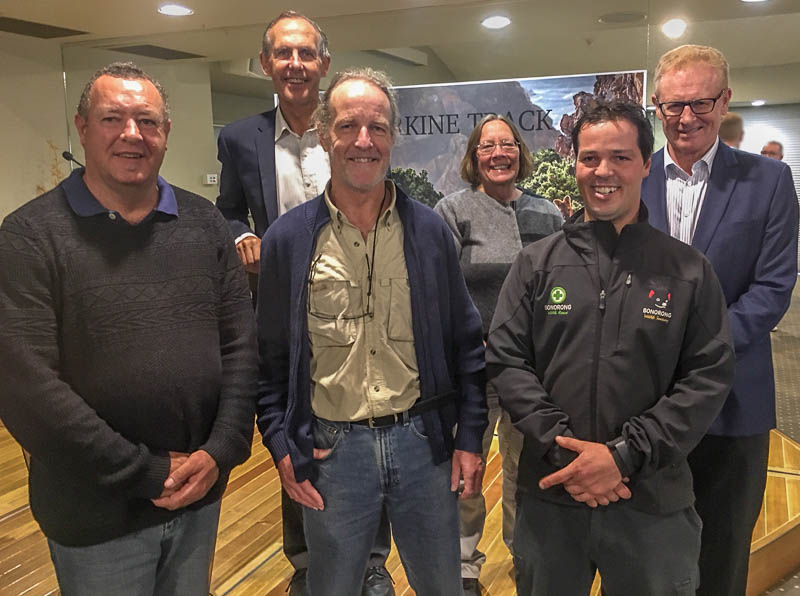
The Bob Brown Foundation last week met with Circular Head tourism stakeholders to discuss plans for the proposed Trans Tarkine Track.
The meeting was held at Tall Timbers on Wednesday (October 26) where Scott Jordan on behalf of the Bob Brown Foundation and the director of Bonorong Wildlife Sanctuary Greg Irons presented the proposal.
Plans for the project were released in June with the hopes of creating a 100-kilometre walk through the Tarkine wilderness and along the north-west coast.
Circular Head Tourism Association president Clint Walker attended the meeting.
“From a tourism aspect, the proposal sounds fantastic. It’s the type of development, a highly desirable attraction, that north-west Tasmania needs in order to have any chance of maintaining our share of the growing Tasmanian visitor market.”
Read the full article on chcronicle.com.au here.
Trans Tarkine Track Video
A video announcing the Trans Tarkine Track proposal was launched today by the project supporters - Bob Brown Foundation, Aboriginal Land Council of Tasmania, Bonorong Wildlife Sanctuary, Corinna Wilderness Experience, Tarkine Trails, Tarkine Wilderness Lodge, and Tasmanian Aboriginal Centre.
Front: Graeme Gardner (Aboriginal Land Council Tasmania), Martin Hawes (Walking Track Design and Management), Greg Irons (Bonorong Wildlife Sanctuary), Back: Ken Boundy (part owner Corinna Wilderness Experience), Heather Sculthorpe (Tasmanian Aboriginal Centre), Bob Brown
Enjoy the video, then read the report here.
Trans Tarkine Track Report
Report on a preliminary survey of a Trans-Tarkine Track

Summary
This report presents the findings of an investigation into the feasibility of constructing a multi-day walking track that will traverse the heartland of Tasmania’s Tarkine wilderness. The report discusses the recommended route for the track, the recreational opportunities that the track will offer, the requirements and likely costs of constructing the track, and potential locations of campsites.
The Bob Brown Foundation commissioned the study, which spanned the period September 2015 to April 2016. The study involved 70 days of fieldwork, a day-long aerial survey by helicopter, and detailed study of topographic data including vegetation maps and satellite imagery. The on-ground survey covered more than 90 per cent of the proposed track. Most of the remaining sections were inspected by helicopter.
The proposed track will be of Class 3 Standard, comparable to the Overland Track. It will be suitable for use by walkers of moderate fitness and limited overnight walking experience. Walkers will overnight at campsites provided with elevated tent platforms and toilets, close to sources of potable water.
The key findings of the investigation are as follows:
- It will be possible to undertake the walk as a continuous 10-day trip or as two separate 5-day trips, broken at the Western Explorer Road. Roughly three days will be spent in the region’s rainforests, two days on highland traverses, two and a half days on the coast, and two and a half days in lowland heath or scrub country.
- The ten-day walk has the potential to rank as one of the world’s great wilderness journeys.
- Each half of the walk has the potential to rank as a world-class multi-day wilderness journey.
- The walk will terminate with a ferry trip from Pieman Head to Corinna.
- Each day of the trip will involve walking between 10 and 15 km. Most days will involve some uphill sections.
- The proposed track and its associated infrastructure can be constructed using straightforward and well-established track construction techniques. Several large bridges will be required and large numbers of steps (which are expensive relative to level track) will be required on some sections.
- There are suitable locations for ten campsites along the track. Of these, five will be inland beside major creeks and rivers, one will be high on Mt Bolton, one will be in rainforest, two will be on the coast near river mouths, and one will be near the track terminus at Pieman Head.
- The carrying capacity of the track will be determined by the capacity of its campsites. I recommend that the campsites be designed to accommodate an initial intake of 30 walkers per day. Campsite infrastructure can be expanded to accommodate higher numbers if there is sufficient demand.
- A detailed on-ground survey, backed up with additional aerial survey (ideally using LIDAR if available) will be required to optimise and fine-tune the proposed route before track construction can commence.
- The overall cost of the proposed development will be just under $20 million. Of this roughly $17 million will be for track construction, $2 million will be for campsite platforms and associated infrastructure, $400,000 will be for vegetation clearance, and $275,000 will be for the detailed ground survey.
- This study has not assessed the costs of car parks, trailhead infrastructure, road upgrades, marketing, the set-up of a walker registration (booking) system, or additional aerial survey.
- The impacts of the proposed track on the ecological, human heritage and wilderness values of the region should be rigorously assessed before the track is constructed.
Download the full report here (10MB PDF).
